Sketches of Pre-Harvey County and Settlement of the Area
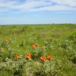
Native Americans, a few homesteaders, waving blue-stem grass and trees along streams describe south central Kansas in the late 1860s. The Kansas-Nebraska Act (1854), the building of railroads across Kansas, the Homestead Act (1862), and the end of the Civil War (1865) brought into what was to become Harvey County numerous families from Ohio, Illinois and Indiana, looking for cheap farm land. Early settlers watched great herds of cattle being driven along the Abilene/Chisholm Trail as they went past Sedgwick, through present-day Newton, and on north to Abilene, Kansas.
Through on-line exhibits, a series of slideshows gives short stories about Harvey County and its cities. Check the website regularly for the addition of new on-line slideshows in this series on Harvey County, Kansas.
For even more stories of Harvey County’s people and businesses, check out our blog, “Voices of Harvey County” on the About Us tab.
Click anywhere on the first image below to scroll through Unit 2 — Sketches of Pre-Harvey County and Settlement of the Area.
- Click this slide to start Unit Two on “Sketches of Pre-Harvey County and Settlement of the Area.”
- Harvey County surveyors, ca. 1870. Following earlier European explorers and fur trappers, surveyors were among the first white people in Kansas. Their main task was to measure the surface of the earth and record the data for the government and railroads. They meticulously marked and measured the prairie, establishing townships and square sections of land.
- Meridian Road in Harvey County, Kansas. Running north-south in Harvey County, Meridian Road goes through the west edge of Newton. Meridian Road’s name was derived from its location on the Sixth Principal Meridian. Prior to the system of numbering highways, Highway US-81 was known as the Meridian Highway due to its close proximity to the 6th Principal Meridian. What’s the significance of the 6th Principal Meridian? In 1855-56 and under the US Public Land Survey System, the Initial Point of the Sixth Principal Meridian was established on the 40th Parallel North latitude. It is located near present-day Mahaska, Kansas. This reference point controls the system of sections, townships and ranges of public land surveys in Kansas, Nebraska, and parts of Colorado, Wyoming and South Dakota. Photo shows Meridian Road in Newton, KS. Photo by Ronald Dietzel. May, 2017.
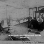
- Surveyor’s Pay and Tools. The earliest Kansas surveyors were paid per surveyed mile. Their compensation was $12 for standard lines, $7 for exterior lines of townships, and $5 for interior subdivisions. Surveyor’s basic tools were the chain, the compass, the transit and the level. Normally 66′ long with 100 links, the chain is used to measure distances. The compass determines the direction of the line being surveyed. The compass needle points to the magnetic north pole. By turning in the direction of the line being surveyed, the direction is established. The transit is used to measure both horizontal and vertical angles. The level is used to determine elevations. Photo: HCHM Collection.
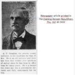
- Quincy Vaughan, Harvey Co Surveyor. In 1856, Vaughan worked in eastern Kansas Territory surveying for the United States government. He took a civil engineering course prior to working for the government. By 1874, Vaughan settled in Kansas with his wife and three sons on a homestead near Peabody. In 1898, he moved to Newton. Vaughan continued his surveying work throughout his life and served as Harvey County Surveyor for fourteen years. He died in 1918.
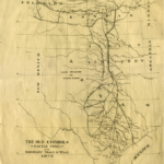
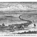
- A Cattle Trail Traversed Harvey County. The Abilene/Chisholm Trail, 1867-1889, is one of the most important but possibly least known trails in American history. Realizing Texas cattlemen were having difficulty getting their herds to eastern markets, Joseph McCoy (a cattle dealer and businessman from Illinois) played a major role in establishing Abilene, Kansas as a rail head. He convinced the Kansas Pacific Railway to build a spur to Abilene, Kansas. McCoy then built a hotel, stockyard, office, and bank in the town. He followed through by promoting the rail head very aggressively and convinced Texas cattlemen to bring their herds to Kansas. In September 1867, longhorn cattle started to arrive in Abilene. The cattle were loaded onto trains and shipped east.
- Herds of longhorn cattle from Texas used the Abilene/Chisholm Trail to pass through south central Kansas and today’s Harvey County on their way north to Abilene. After some passage of time, the cattle trail came to be called “The Chisholm Trail” after Jesse Chisholm (a trader, guide and interpreter) since a portion of the cattle trail followed part of his wagon route which moved supplies between Chisholm’s trading posts in Indian Territory and at Wichita, Kansas. Depending on the time period and the people who were talking or writing, the Eastern, Abilene and Chisholm Trail System was called “the trail,” the “Abilene Trail,” the “Kansas Trail,” the “Texas Trail,” or the “Northern Trail.” Illustration by Prof Henry Worrall (Topeka, KS). Used by Joseph G. McCoy in “Historic Sketches of the Cattle Trade of the West and Southwest.” Published by Ramsey, Millet & Hudson, Kansas City, MO. 1874.
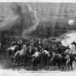
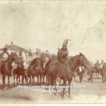
- Drove of Texas Cattle Crossing a Stream. With the reality of immense profits to be made, Texas cattlemen looked for the nearest rail heads, resulting in an era of cattle drives going to Kansas cowtowns. More than four million longhorns were trailed north over the Abilene/Chisholm Trail. Newton developed into a well-known (but short lived) cowtown when the Santa Fe Railway selected a town site which would become Newton. By establishing a rail head here, the herds going to Abilene to their competitor, the Kansas Pacific, were intercepted at Newton. Joseph McCoy oversaw the building of Newton’s stockyards and convinced the drovers to sell their herds here. Beginning in July 1871, almost 31,000 cattle left the Newton stockyards during the 1871 season. In March of 1872, a Santa Fe branch line reached Wichita which caused a dramatic decline in Newton’s cattle shipments as Wichita became the primary cowtown.
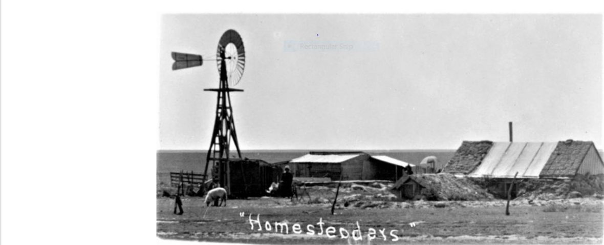
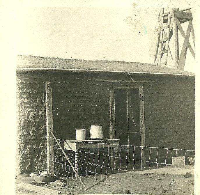
- “Soddy” (sod house) in Harvey, Kansas. After the Civil War, there was a growing interest in settling the vast prairies west of the Mississippi River. Looking for cheap farm land, families and individuals immigrated to present day Harvey County. Early on, they came from Ohio, Illinois, and Indiana. Others were Welsh, Irish and French-Canadian settlers. Later, emigrants came from Pennsylvania, Germany, Ukraine (southern Russia), and West Prussia (present day Poland). Among the homesteaders were Civil War veterans. For those vets who had been on the Union side, there were special land concessions. In 1870 federal legislation, vets received 160 acres within the railroad grant areas. Legislation in 1872 deducted the length of their war service from the five year residency requirement. Photo from HCHM collection.
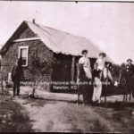
- One of the first good “soddys” in Harvey County. People and location in Harvey County are unknown. Most of the earliest homesteads in present-day Harvey County were established in 1869. Many were located in the general vicinity of the town of Sedgwick and Sedgwick Twp. A portion of the town of Sedgwick was laid out. Early settler names within the Sedgwick area were Floyd, McOwen, Schaeffer, Corgan, Wright, Decker, Hurd, and Wetherell. Additional settlers in 1869 were reported to have been living in the following townships (twp) of Harvey County. In Richland Twp, there were Neiman, Lawrence, and Wilcox who settled on the West Whitewater River. In Lakin Twp, there were Kimball and Hanna. In Macon Twp, there were Perry, Cleveland, Alexander, and Goody who had a cattle ranch. Photo: HCHM collection.
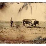
- 1880s farming. By 1870, settlers were living in the following townships of Harvey County. In Darlington Twp, there were Doty, Winn, Berry, Marks, Hildreth, Geary, Stockwell, Gingress, Allen, and others. In Halstead Twp, there were Corgan, Cooper, Schoonover, Olson, Miller, and Brewer. There were several families of French and Irish settlers on the Little Arkansas River in Garden Township and at the mouth of Turkey Creek in Alta Township. Photo: Half plate tintype from KS Historical Society collection.
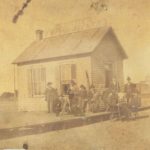
- Within the following townships of Harvey County, the earliest settlers appeared in 1871. In Highland Twp, there were Hengst, Patterson, Sharp, Berry, Livingston, Hackney, Johnson, Elwood, Caveny, Davis, and others. In Lake Twp, there were McMurray, Patterson, Gorgas, and others. In Burrton Twp, there were Blades and others. In Emma Twp, there were Bean, Munger, Webster, and others. In Walton Twp, there were Kline and others. In Pleasant Twp, there were Harlan, Ray, Owen, Shelden, Kettle, Denny, Chamberlain, Powell, and others. In Newton Twp, there were Baker and Perkins. Photo from HCHM collection.
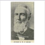
- Judge Robert W.P. Muse (1821 – 1896). Probably the one most important person in the development of both Harvey County and Newton was Judge Robert W.P. Muse. He was a businessman, lawyer, editor, politician and promoter of Harvey County and Newton. In his business capacity, Muse (along with Capt R.M. Spivey) took charge of the land department of the AT&SF railroad. They conducted a large business of handling nearly all the AT&SF company lands in Harvey and adjoining counties. Muse assisted in laying out the city of Newton. Muse’s other business interests included a lumber yard, property owner, builder, and banking. In the political arena, he gave leadership to the 1872 formation of Harvey County. Elected in 1881, Muse was Newton’s mayor for two years.
- Santa Fe Railway Survey Party of 1870. A surveying and appraisement party from the AT&SF railway left Topeka in August of 1870. Among the group were D.L. Lakin, AT&SF Land Commissioner, and Judge Muse. Their task was to survey the topography of the land and to secure a description of each section. Also, they were charged with selecting a point west of Cottonwood Falls as the location of an office for the sale of railroad lands. In the words of Muse, “…the agency…had been tendered to us at any point west from Cottonwood which we might select.” Working slowly westward from Emporia, the party traveled well-armed in a covered wagon. They met bands of Arapahoes, Cheyennes, and Comanches who resented the invasion of their country. Photo from HCHM collection.
- Judge Muse Described Area of Today’s Harvey County in 1870. Traveling southwesterly from Cottonwood Falls, the survey party journeyed through the future sites of Florence, Peabody and Walton until they reached Sand Creek. In Judge Muse’s History of Harvey County: 1871 – 1881, he says that at this location, “…for the first time, we struck the Chisholm, or great Texas cattle trail…. Here we were informed by Mr. Lakin that a station or town would be laid out on either Section 17 or 19….” In traveling south on August 28, 1870 along the Chisholm Trail, Judge Muse observed, “…down on the west side of Sand Creek as far as the mouth of the creek, …we found Dr. T.S. Floyd, with whom we staid [sic] all night…. After traveling over thirty miles, we had seen no human habitation or sign of civilization, our way being through high prairie grass, often standing above the height of our wagon wheels…. Muse then continued, “When we first visited the county, large herds of buffalo were found in the western portion … especially where Burrton now stands, and between the two Arkansas Rivers.” Muse reported on the presence of wolves, coyotes, antelope and prairie chickens; and that, “…we were beset by swarms of buffalo gnats and mosquitoes….”
- Muse and Spivey Land Office, regional agents for Santa Fe Railway. Per an 1896 article in the Newton Kansan, what early settlers found when they arrived in the area was “…a wild sea of waving grass, and wild game of all kinds abounded….” It was in these surroundings that R.W.P. Muse, having lived in Abilene (KS) for a time, decided to seek his fortunes when he moved to Newton’s site in May of 1871. Locating a land office close to the depot on Newton’s Main Street, Muse and his business partners Capt. R.M. Spivey and John A. Randall “negotiated the sale and exchange of property, farms, and farming lands as regional agents for AT&SF Railway, Arkansas Valley Company, and Newton Town Company.” Also Muse, Spivey and Co. advertised “We keep…on hand the largest and best assorted stock of lumber, sash, doors, etc. in the Arkansas Valley.” With this double pronged business model, the partners improved their success rate by selling land and then offering the materials needed for constructing buildings on the buyer’s property. Photo from HCHM collection.
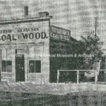
- Land Office of Muse, Spivey & Co., regional agents for “railroad land.” Erected in 1871 at a location in Newton’s 600 block of Main Street, this wood frame building was moved to 311 Main in 1878 or 1880. Muse, Spivey & Co. operated from this building as regional agents for the sale of “railroad land.” For homesteaders wanting to acquire “government land” under the Homestead Act, they went to the federal land agent office in Wichita. According to Muse, “…every township in present-day Harvey County had bona fide and permanent settlers by the spring and early summer of 1871. By January 1872, all unoccupied government land of any value in Harvey County had a filing upon it at the government land office.” The influx of people produced a scattering of towns, villages and settlements across the region. One of them was Elivon, a small community in McPherson County just north of present-day Hesston. It was established in 1871 by a group of French Canadians. Photo from HCHM collection.
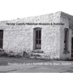
- Residence of John Randall, 307 N. Main, Newton. Local legend has circulated for years about this stone building at 307 N. Main being the land office of Muse & Spivey. In reality, the stone building was a combination residence and office for John Randall. Subsequent to Randall’s ownership, the stone building changed hands a number of times and was used for a variety of businesses. After being severely damaged in a storm, the stone building was torn down in 1967. Documentation shows the land office was in the wood frame building (shown in the previous slide) which was moved to the 311 N. Main site in 1878 or 1880 and placed immediately next door to Randall’s residence. By at least 1885, the land office building was repurposed when J.W. Edwards took it over for his coal company. The business saw several ownership changes with it eventually being operated by Frank Nicholson. An individual bought the wood frame building in 1915, moved it to West Fifth street in Newton and added it to his residence. Photo from HCHM collection.
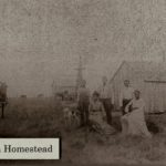
- An 1871 homesteading story of one family… The Homestead Act of 1862 allowed anyone to file “first papers,” pay a $10 fee, and claim 160 acres of land in the public domain. Like many other black families, David and Mary Anderson seized the opportunity to have title to their own land.
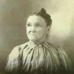
- Mary Rickman Anderson Grant. In 1871, the Anderson family traveled by covered wagon to Florence, Kansas. The family stayed there while David, the husband, went to claim a homestead in present-day Harvey County, Pleasant Township, Section 26. They lived in a small sod house. The boys “slept in swinging beds hung from the cellar rafters so that they would be protected from snakes and insects.” Fuel was scarce, so like other homesteaders, the Anderson family relied on cow chips and corn stalks for cooking and heating.
- Tragedy Struck, Hardships Overcome and Dream Was Realized. The rest of the story… Tragedy struck the family on April 3, 1872 when David died, leaving Mary and eight children on the prairie homestead. Throughout the hardships, Mary kept her family together and eventually was able to realize the dream of owning her farm. In 1889, Mary made the final $8 payment on her homestead in Pleasant Township. The farm was officially hers.
- This pictorial history unit about Harvey County was compiled by Ronald Dietzel. Acknowledgement – Through their input and suggestions, Kristine Schmucker (HCHM Curator) and Jane Jones (HCHM Archivist) made significant contributions to the compilation of this unit. See more in the on-line series “Short Stories of Harvey Co, KS.” View Unit #3 to see “Harvey County: Home of Trails.”
